District of Kent
January 12, 2025 By: Jennifer R. Paulsen
Location: Agassiz, BC Canada

Mark Butorac
HIST 3991: Environmental History
Jennifer R. Paulsen
January 12, 2025
Local Environmental History
The environment that I currently call home has undergone a significant amount of development (or destruction depending on the lens through which you view the situation) in the 300 or so years since first contact was made with Indigenous peoples by European settlers. The most visible changes have occurred within the last 150 years.1 The environment and its original inhabitants have certainly been subjected to a lot more changes than they had experienced during the approximately 10,000-year period before the area was converted from its natural state of various habitats including wetlands, forests, mountains, and a vast network of rivers and streams populated by diverse flora, fauna, and First Nations peoples to the hallmark of Western civilization we (I) live in today.2
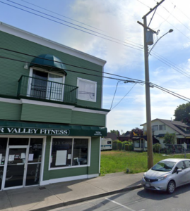
I live on Pioneer Avenue, the main drag running through the tiny town of Agassiz in the district of Kent on the unceded traditional territory of the Stó:lō Nation. A fraction of this land is still independently governed by First Nations bands including Seabird Island Band, Cheam First Nation, Sts’ailes Nation, Sq’ewlets First Nation, and Yale First Nation. In addition to the federally reserved lands of the First Nations listed above and the town of Agassiz, the district of Kent also includes the communities of; Rockwell Drive, Mount Woodside, Harrison Highlands, and Harrison Mills. Kent lies in the Fraser Valley on the North side of the Fraser River and is comprised mostly of designated agricultural zones with a few commercial/residential districts, some suburbs, and government facilities including an environmental research center and two federal prisons.3 Much of the developed land – including the town of Agassiz- is situated in a floodplain.
According to Keith Thor Carlson, the best way to determine how land has historically been used is by looking at who was using it, how many of them were there, and what were they using it for? I discovered this helpful tip in a book called, You Are Asked to Witness: The Stó:lō in Canada’s Pacific Coast History, in which Carlson says that changes in land use can be gleaned by looking at the population((s) using said land.4 When it comes to land use in the district of Kent one encounters a clear division between the ways the land has been used by Indigenous and settler populations who have very different approaches to using the land for cultural and sustenance purposes.
Until the late 1700s, this area of Turtle Island was home to between 7000-28,000 Stó:lō people whose prosperous existence- as the meaning of their name which translates to ‘river’ implies- centered around what we now call the Fraser River5. Oral histories detailing the Stó:lō way of life have been passed down through the generations and are evidenced in objects such as weavings which commemorated ceremonial governance and artifacts such as baskets, fishing gear, and clothing that were used in daily life. Though much of the oral history and language of the Stó:lō has been lost as a result of colonization and the implementation of the residential school system, one is able to piece together a basic idea of life before contact through the tireless efforts of Stó:lō elders and historians. The traditional Stó:lō economy revolved around seasonal hunting, fishing, and gathering activities and the rights to use specific sites for these
purposes were granted publicly through potlatch ceremonies and based on familial succession.6
How the land has been used in more recent history and how it is currently being used reflects, in opposition to the sustainable traditions valued by the Stó:lō, the distinctly capitalistic values of colonial settlers that have come to dominate the land. The district of Kent was officially incorporated in 1895 when farming, which had begun in the early 1800s, was being practiced by a small settler community but the construction of the Canadian Pacific Railway sparked major settlement, and the concomitant ideologies of colonialism, capitalism, and Christianity began encroaching on the ecological, economic, and social structures that had existed in the region for thousands of years.
Today, the First Nations within the district of Kent, according to census data, comprise approximately 47% of the population and govern reserved lands that account for less than 10% of the physical area. 7 The use of productive land in the district of Kent continues to be dominated by capitalist interests which prioritize infinite growth as opposed to protection of our finite resources.
References:
Carlson, Keith Thor. (1997). You Are Asked to Witness: The Stó:lō in Canada’s Pacific Coast History. Stó:lō Heritage Trust.
Stewart, John, Favrholdt, Ken. (2015). “Kent.” The Canadian Encyclopedia. https://www.thecanadianencyclopedia.ca/en/article/kent
District of Kent. (2014). Division of First Nations reserve and Settled land in Kent. Map 2 https://www.kentbc.ca/uploads/18/Doc_636900746874522799.pdf
Ministry of Agriculture. (2015). District of Kent. Agricultural Land use Inventory. Report. https://www2.gov.bc.ca/assets/gov/farming-natural-resources-and-industry/agriculture-and-seafood/agricultural-land-and-environment/strengthening-farming/land-use-inventories/fvrd2013_kent_aluireport.pdf
Statistics Canada. (2023). British Columbia Municipal Populations Census :1921-2021. https://www2.gov.bc.ca/assets/gov/data/statistics/people-population-community/population/municipal_census_pop_1921_2021.pdf