Alámex Becoming Agassiz
January 26, 2025 By: Jessica Kampen
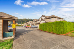
Location: Morrow Rd, Agassiz BC
Jessica Kampen
HIST 3991: Environmental History
January 26, 2025
Alámex Becoming Agassiz: An Environmental History
I live in Agassiz, on Morrow Rd. Agassiz is a small farming town within the District of Kent. As a resident for just under 30 years, I have witnessed the town’s growth as residences have replaced what was once farming land. The town is situated on the unceded and traditional ancestral lands of the Cheam, Sts’ailes, Sq’éwlets and Seabird Island people. The alternative name for Agassiz is Xwchíyò:m, which translates to Wild Strawberry Place.
Miller writes that the area was originally known as Alámex, but shortly after 1827, it was mostly abandoned. Oral history states that a very angry and aggressive man lived in the area, and to get away from him, the people moved to other nearby regions. This has been demonstrated through census data collected by the HBC. The people who were originally living there were believed to be ancestors of the sturgeon, as they were in abundance in the region.
Located at the eastern end of the Lower Fraser Basin of the Fraser Valley, the region is rich in ecosystems. Europeans first arrived in the Fraser Valley in 1827. However, it was not until 1895 that the District of Kent was incorporated. The Agassiz family, which the town is named after, came to the region in 1867 from Essex, England. Agassiz follows the Ecological Imperialism model as the area has seen an increase in invasive species, and the demographic comprises 84% European dissent.
In 1889, following Prime Minister Sir John A. Macdonald’s Experimental Farm Act, land was allocated for the Dominion Experimental Farm. This land was chosen because the soil was rich and fertile. It was and still is used to cultivate crops for horticultural research. The Agassiz Dominion Experimental Farm gave early settlers a deeper understanding of the climate and soil conditions, which allowed them to identify crops best suited for the area.
Agassiz residents demonstrated adaptability when the flood of 1948 destroyed their hop industry. Corn became the new crop within the region. At the time, farmers would select their best cobs each year and save them to plant the following year. Corn is still a dominant crop in Agassiz.
Bob Forbes asserts that little is known about the population sizes of animals in the region at pre-contact times. However, archaeological evidence shows a decline in the populations of black bears, elk, waterfowl, and grizzly bears. The populations of rodents and rabbits, however, have not changed significantly, while the population of black-tail deer has increased.
As C. A. Boyle and others discuss, the region has experienced significant changes in ecosystem functions since European contact. The area has seen a 5% loss of native plant species in the last 100 years; this is believed to be due to urbanization and agricultural land clearing. Native vegetation has been replaced by alien species at a rate of 41%. Human interactions with the ecosystem have caused a decline in net primary productivity along with soil organic carbon.
Four plant species are currently listed as invasive within Agassiz: knotweed, giant hogweed, common bugloss, and Himalayan Balsam. These plants can damage pipes, cause soil erosion, and human injury, and most importantly, they can negatively affect native plants through nutrient competition. The District of Kent sprays herbicides every spring and summer to control invasive plants. The district promotes native plants by partnering with the Fraser Valley Conservancy and planting them throughout the region.
Agassiz depends on groundwater wells near the Fraser River to provide water to the townsite. The district operates a wastewater treatment plant that was recently upgraded for increased sewage processing. The district has also implemented climate mitigation measures to decrease our environmental impact. These measures include Replacing streetlights with LEDs, planting 22 new trees, improving sidewalks for accessibility, installing solar panels and new bike racks to encourage alternative transportation, installing EV charging stations, updating culverts, and e-billing to decrease paper waste.
Agassiz further strives to promote the quality of the land through its community garden. This not-for-profit organization teaches locals how to grow in environmentally friendly and sustainable ways. The gardens are intended to also provide positive social interactions and a sense of community belonging.
Agassiz is nestled in the traditional territories of the Cheam, Sts’ailes, Sq’éwlets, and Seabird Island people. It demonstrates the complexities of interactions between human settlements and the natural environment. While it has grown significantly, it also identifies the need to pursue sustainable practices in recognition of our environmental impact. I believe my town is succeeding in acknowledging our land’s history and working towards a more harmonious future.
References:
“Kent, British Columbia” Wikipedia, Wikimedia Foundation, December 1, 2024, https://en.wikipedia.org/wiki/Kent,_British_Columbia
“Living Here”, The District of Kent. (2024) https://www.kentbc.ca/en/living-here/living-here.aspx
The Agassiz-Harrison Historical Society, “Knee High by the First of July: Celebrating the Legacy of Corn in the District of Kent, British Columbia” (2019) https://www.communitystories.ca/v2/knee-high-1st-july_hauteur-genou-1-juillet/
Boyle, C.A, et al. “Changes in Land Cover and Subsequent Effects on Lower Fraser Basin Ecosystems from 1827 to 1990.” Environmental Management, vol. 21, no. 2, 1997, pp. 185-196, https://www.sccp.ca/sites/default/files/species-habitat/documents/changes%20in%20land%20cover%20%26%20effects-lower%20fraser%20basin%201827-1990%20boyle%20et%20al%2090_0.pdf.
Stewart, John, Favrholdt, Ken. “Kent.” The Canadian Encyclopedia. (2015). https://www.thecanadianencyclopedia.ca/en/article/kent