Middlesex Center
March 24, 2025 By: Alyx Mcintosh
Location:
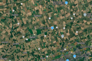
I live in the countryside of Middlesex County (municipality of Middlesex Centre), close to a small rural community called Ilderton. Where I live, I am surrounded by farmland. Many farms have been passed down for generations, one in particular has been passed down for six generations, as far back as the 1850s (Williams, 2023).
Ilderton is a small rural community, located halfway between Lake Erie and Lake Huron (Ilderton, 2007). In the late 1800s, Ilderton had a population of 200 (W.A. & C.L. Goodspeed, 1889). The community has growth considerably in the past few decades, in the 1980s their population had not grown much since settlement, it was only a few hundred. Now the population has grown to over 2500 people (Ilderton, 2007). Bordering the town of Ilderton is the Medway creek watershed, a subsection of the Upper Thames Watershed. Here, 77% of the land is agricultural. Vegetation covers 11.5% of the watershed, consisting mostly of deciduous forests (74%), and meadow (17%). The remainder of vegetation cover consists of mixed forest (4%), coniferous plantations (3%) and thicket (3%) (UTRCA, 2022).
First Nation populations first appeared in the area in the Mid Woodland Period, attracted to the abundance of fish in the local waterway. Late into the Woodland period, corn, beans, and squash became a common fixture. Shortly thereafter, Iroquoians began clearing plots of land near small creeks and streams, to growing crop and build infrastructure. However, by 1500 the area was abandoned by the Iroquois communities, it is not known why (Friends of Medway Creek & UTRCA, 2009). Much later, the first settler arrived from Scotland in 1817, followed by a group of Irishmen in 1818 (Heritage Property Index, 2025).
The soil composition allowed agricultural endeavour to flourish. The terrain consisted of alluvial flats, with clay soil and a rich vegetable mould layer on top (W.A. & C.L. Goodspeed, 1889). Water resources were abundant, the river systems in the area were extensive, providing spring water on the surface as well as ample groundwater (Simner, 2010). Forest cover at this time was primarily comprised of the eastern hemlock, while hardwood trees such as the maple, oak, and elm were also abundant 1889. When acquiring new land for agriculture, perspective land owners looked at the tree species populations to evaluate soil properties. Lands covered with a blend of oak, ash, elm, beech, basswood, and sugar maple, along with smaller populations of pine and balsams indicated the most fertile soils (Simner, 2010).
The area remained relatively vacant during European settlement, however in the late 19th century and throughout the 20th century much of the land has been cleared for agriculture and urban development (Corlon Properties Inc.). Accordingly, from the 1850s to the 1890s, the farms in the community expanded, incorporated new technologies, and changed their crop preferences (Van Allen, 2016). During this time, the first road system was developed in 1853. Pollution to the Thames River has been noted as early as 1871, cause by London’s oil refineries (Middlesex County, 2023).
After mass forest clearings in 20th century, floods became a regular occurrence along the Thames. Major flooding events in 1937 and 1947 lead to the creation of the Upper Thames River Conservation Authority (UTRCA) (UTRCA, 2004). The UTRCA was appointed to address flooding issues, reforestation, and wetland preservation (Quinlan, 2013).
Evidently, the alteration of the natural environment does not equally support the areas native species. As of 2022 there are 3 fish species at risk, 15 bird species, 4 plant species, 5 reptile species, as well as the monarch butterfly. Dense vegetation cover is limited. Interior forests, meaning the area of forest that is 100m inside the tree-line, are particularly limited in the area. Interior forests are important particularly for sensitive bird habitat, since the outer 100m is vulnerable to wind damage, predation, and invasive species. Even so, between the years 2000 and 2015, 99 hectares of forest have been cleared for urbanization, agriculture, and aggregates. Between 2010 and 2015, 16 hectares of forest was gained, as a result of 20-30 year old planting sites (UTRCA, 2022). Furthermore, within the last 10 years, the emerald ash borer has appeared. Since ash trees are common in forest stands, there is a threat of non-native species growing in place of the Ash (Quinlan, 2013).
Interestingly, according to the Medway Creek Community-based Enhancement Strategy, the soil erosion levels are low (less than 3 tonnes/hectare/year) Many farms (85% of farms in the Medway Creek watershed) in the surrounding area implement soil conservation practices, including crop and grazing rotation, winter cover crops, vegetative water buffers, and windbreaks (Friends of Medway Creek & UTRCA, 2009).
Climate change has lead to changes in weather patterns, with warmer, drier air from October to November, and cooler temperatures in May. This pattern is reflected in the groundwater supply level, which has also began to shift (UTRCA, 2022). Be that as it may, in the last decade, water quality in the Thames River has remained consistent, despite population growth in the area. Stewardship projects, such as tree planting, naturalization projects, environmental regulation, and upgrading water treatment equipment have all contributed (Quinlan, 2013).