Nago, Okinawa, Japan
July 4, 2025 By: Kai Maekawa
Location: 26.59830813215734, 127.98796779270342
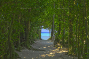
I am from Okinawa, the southernmost islands of Japan. Here, a subtropical climate keeps the landscape lush and green year-round, and vibrant coral reefs thrive in the turquoise-blue ocean. Tourism drives the local economy, yet Okinawa’s environmental history remains closely tied to its human history. This includes early Indigenous settlements, resource use and ecological changes, colonization that reshaped the land, the devastating impacts of war, ongoing military presence, and recent challenges posed by global warming. As I studied the articles in the first unit, it became clear that many of the theories discussed are directly applicable to Okinawa’s experience. The Okinawa archipelago consists of more than 600 islands, though only 37 are inhabited, and I live on the main Okinawa island.
The district where I live is located in the northern part of Okinawa’s main island, in a place called Nago. Understanding Nago’s ecological history begins with its pre-contact period, as this provides important context for subsequent changes. Archaeological surveys within the current boundaries of Camp Schwab have uncovered shell middens, fishhooks, and evidence of human habitation dating back at least 3,000 years (Chen, 2023). These findings confirm that Indigenous Ryukyuan people actively harvested reef resources and managed coastal landscapes. Early residents collected shellfish, fished, and maintained forested slopes for practical and spiritual purposes. Traditional practices included preserving sacred groves called utaki, where tree cutting was forbidden, and planting fukugi trees around homes as windbreaks against typhoon winds. The practice of planting fukugi next to the house is still widely practiced and being able to see them in my neigbourhood. Also, I live next to Utaki and we have several ritualistic events every year to honor the spirits of the land.
As the population grew during the Ryukyu Kingdom period (fifteenth to nineteenth centuries), resource extraction intensified. According to historian BuYun Chen, rising demand for timber, charcoal, and construction materials began to outpace the forests’ natural regeneration, and by the early 1700s, royal surveys reported that the mountains were nearly bare due to overharvesting (2023). Recognizing the environmental impact, Ryukyuan leadership implemented conservation policies in 1737 through the establishment of the Yamabugyōsho (Office of Forest Administration). This administration mandated systematic replanting of pines and oaks, designated protected groves, and regulated forest use. These actions demonstrate an early recognition of the need to balance resource use with ecological conservation.
The period from the 1940s through the 1960s brought significant ecological transformations to Nago, primarily due to World War II and subsequent military activities. In 1945, heavy bombardment stripped the hillsides of vegetation, forcing 25,000 civilians into the Ōura-saki internment camp, where survival depended on limited resources such as seaweed (Keiser, 2019). After the war, U.S. occupation forces designated coastal areas around Henoko for military use, and by 1959, Camp Schwab had been established, replacing mangroves and coral flats. Military operations included dynamiting reefs to create landing channels, and rapid commercial development near the base led to untreated sewage flowing into nearby waters (Keiser, 2019). Additionally, the introduction of invasive species, such as the small Indian mongoose in 1910, further destabilized local ecosystems by preying upon native birds, including the Okinawa rail (Ministry of the Environment, 2024). Combined, these events deeply reshaped Nago’s environmental landscape.
The ecological consequences of military presence persist today, notably with the ongoing relocation of the U.S. Marine Corps Air Station from Futenma to Henoko. Since 2017, large-scale land reclamation efforts have involved depositing approximately 21 million cubic meters of fill material onto coral reefs in Ōura Bay (Palz, 2021). Despite attempts at coral transplantation, mortality rates remain high. Furthermore, marine mammals like dugongs have not been observed since construction began, and sedimentation from these operations continues to harm critical seagrass habitats. Thus, the ongoing base relocation significantly impacts the biodiversity and ecological integrity of the region.
As a small island region continually sandwiched between larger powers like Japan and the United States, we struggle to keep our land conserved (Palz, 2021). We do not have much power to influence the political decisions made above us, and in this sense, Okinawa occupies a unique position in environmental history, especially regarding how international politics and conflicts have shaped our landscape.
Reference
Chen, B. (2023). “To embrace and protect”: Managing wind, water, and trees in the Ryukyu Kingdom. Isis, 114(3), 611–618. https://doi.org/10.1086/726185
Ministry of the Environment, Government of Japan. (2024, September 3). Declaration of the eradication of the small Indian mongoose (designated invasive alien species) in Amami Oshima Island [Press release]. Ministry of the Environment, Government of Japan. https://www.env.go.jp/en/press/press_03205.html
Palz, M. (2021, December 15). Okinawan coral politics, Henoko base construction and a Japanese political strategy of ignorance. The Asia-Pacific Journal: Japan Focus, 19(24), Article 5659. https://apjjf.org/2021/24/palz
Keiser, K. H., Jr. (2019). Weaponized landscapes: An environmental history of the Battle of Okinawa and its aftermath[Master’s thesis, Appalachian State University]. NC DOCKS Institutional Repository. https://libres.uncg.edu/ir/asu/f/Keiser_Howell_2019_Thesis.pdf