Oakville, Ontario
March 17, 2026 By: Yanran Lu
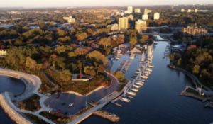
Location: 320 Dalewood Drive, Oakville, ON
Ecological History of the Area Around E. J. James Public School
The area around E. J. James Public School, located near the intersection of Dalewood Drive and Cairncroft Road in Oakville, Ontario, is now a quiet suburban neighbourhood with houses, schools, and parks. However, the land has a much longer ecological history. Over time, the environment of this area has changed significantly due to human activity. By examining the history of Indigenous land use, European settlement, agriculture, and suburban development, we can better understand how the landscape around the Sixteen Mile Creek watershed developed into what it is today.
Long before European settlers arrived, this area was part of the traditional territory of the Mississaugas of the Credit First Nation. The region was covered by forests that were part of the Carolinian forest zone, one of the most biologically diverse regions in Canada. These forests included trees such as oak, maple, and beech. The landscape also included wetlands, streams, and fertile soil that supported many species of plants and animals.
Indigenous communities lived in this region for many generations and had a close relationship with the natural environment. The Sixteen Mile Creek played an important role in daily life because it provided fish such as salmon and trout and served as a route for travel. Indigenous peoples used the land for hunting, fishing, and gathering plants for food and medicine. Their way of using the land was generally sustainable and did not permanently damage the surrounding ecosystems.
The environmental history of the area changed significantly when European settlers began arriving in the early nineteenth century. In 1827, William Chisholm purchased land at the mouth of Sixteen Mile Creek and began developing Oakville as a port and trading centre. As more settlers arrived, forests were cleared across what was then known as Trafalgar Township.
Large areas of trees were cut down to provide timber for building ships and houses. Once the forests were removed, the land was used for farming. By the mid-1800s, much of the original forest had been replaced by agricultural land. Farmers grew wheat and other crops, and later the region became known for fruit orchards. In order to create farmland, wetlands were drained and the natural landscape was significantly altered. These activities affected wildlife habitats and changed the natural flow of water in the area.
Despite these changes, some natural features of the region remain important today. One of these is the Trafalgar Moraine, which was formed by glaciers around 13,000 years ago. The moraine plays an important role in storing groundwater and supporting the Sixteen Mile Creek watershed. Even though farming and suburban development have changed the surface of the land, the moraine still helps regulate water flow in the region.
Oakville experienced another major transformation after World War II. During this time, the population of the Greater Toronto Area increased rapidly, and many people moved to suburban communities. The construction of the Queen Elizabeth Way (QEW) made it easier for people to live in Oakville while commuting to Toronto. As a result, farmland and orchards were gradually replaced by residential neighbourhoods.
The neighbourhood surrounding E. J. James Public School was mainly developed during the 1960s and 1970s. Roads, houses, and shopping areas were built as the town continued to grow. Although suburban development reduced some natural habitats, conservation efforts also began during this period. Areas along the Sixteen Mile Creek valley were protected to help preserve wildlife and natural green spaces.
Today, the neighbourhood around E. J. James Public School reflects many layers of environmental history. The land was first shaped by glaciers, later used and managed by Indigenous communities, then transformed by agriculture and urban development. Even though the area is now suburban, natural features such as Sixteen Mile Creek and nearby green spaces still show traces of the region’s earlier ecological landscape.
References
Halton Region. (n.d.). Sixteen Mile Creek watershed.
https://www.halton.ca
Mississaugas of the Credit First Nation. (n.d.). History and traditional territory.
https://mncfn.ca
Town of Oakville. (n.d.). History of Oakville.
https://www.oakville.ca
Government of Ontario. (n.d.). Carolinian forest region in Ontario.
https://www.ontario.ca