Pemberton Valley
March 30, 2026 By: Elkie Webb
Location: https://maps.app.goo.gl/ysawzJUdp6pxJ6Ug9
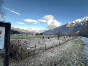
The environmental history of the Pemberton Valley demonstrates that humans function as a keystone species, capable of sustaining or destabilizing ecosystems depending on how they engage with the land. Long before agricultural development, the valley was shaped by the dynamic movement of the Lillooet River, which braided across a glacial floodplain, depositing sediment and creating fertile yet unstable soils. This landscape consisted of wetlands, oxbows, and dense floodplain vegetation, continually reshaped by seasonal flooding and ecological processes.
Within this environment, the Lil’wat Nation developed a reciprocal relationship with the land, guided by ecological rhythms such as salmon runs, animal behaviour, and seasonal cycles. Practices including fishing, plant harvesting, and controlled burning reflect a deep understanding of interconnected systems, where human life was embedded within, rather than imposed upon, natural processes.
This balance shifted with European settlement in the late nineteenth century, as settlers sought to control the valley’s hydrology for reclamation of land use for development and agriculture. Flooding became a problem to be managed, culminating in large-scale engineering projects following the 1940 flood, including river straightening, dyking, and wetland drainage. While these interventions enabled farming and development, they fragmented habitats and disrupted ecological systems.
Today, invasive species, shifting fungal patterns, and climate variability point to ongoing ecological change. Restoration efforts and Indigenous stewardship initiatives aim to rebalance these systems. The Pemberton Valley remains an evolving landscape, shaped by continuous negotiation between natural processes and human intervention.