Sault Ste. Marie, Ontario, Canada
December 28, 2025 By: Emily Tithecott
Location: 95 Mark Street, Sault Ste. Marie, Ontario, Canada
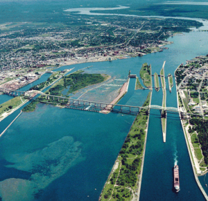
The area around 95 Mark Street in Sault Ste. Marie sits within the traditional territory of the Anishinaabe and is part of the land covered by the Robinson–Huron Treaty of 1850. Long before European settlement, the nearby St. Marys River was central to Indigenous life, acting as a transportation route and a productive fishing area linking Lake Superior and Lake Huron. Species such as lake trout, whitefish, sturgeon, and walleye supported local food systems, while land use followed seasonal patterns that allowed ecosystems time to recover.
Ecologically, this area is part of the Great Lakes–St. Lawrence forest region. Before settlement, the land would have been covered by mixed forest and wetlands that supported a wide range of wildlife, including moose, wolves, black bears, beavers, and many bird species. Nineteenth-century settlement and logging dramatically altered the landscape, clearing forests, fragmenting habitats, and reshaping drainage patterns. Industrial development in Sault Ste. Marie, particularly steel production, further affected air and water quality across the region, including the St. Marys River.
Following the Second World War, suburban development replaced much of the remaining natural land cover with housing, roads, and lawns. Stormwater systems increased runoff into local waterways, while invasive species became established in disturbed areas. Today, stewardship efforts such as stormwater management, tree planting, and the protection of nearby natural areas help reduce environmental impacts, even as the neighbourhood remains closely tied to broader regional ecosystems.