Fort McMurray, AB
April 13, 2026 By: Autumn Rehbein
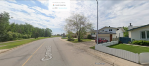
Location: 56°44'04.0"N 111°26'51.6"W
The are around Fort McMurray is part of Alberta’s boreal forest, an ecosystem historically shaped by wetlands, spruce forests, wildlife migration, and the Athabasca River watershed. Before European settlement, this land was used by Cree, Dene, and Métis peoples for hunting, fishing, trapping, and seasonal travel, with the Athabasca River serving as a major transportation route. Indigenous communities sustainably managed local resources such as moose, beaver, fish and waterfowl for generations.
In the late nineteenth century, European settlement introduced fur trading posts and later industrial resource extraction. By the twentieth century, Fort McMurray became central to oil sand development, which transformed the surrounding landscape through deforestation, wetland drainage, road construction, and habitat fragmentation. Areas within the city shifted from natural muskeg and forest into urban industrial infrastructure supporting extraction and city growth. Wildlife in this region has declined in diversity due to habitat loss, particularly species such as woodland caribou. Invasive roadside plants like white sweet clover have spread though disrupted soils created by development and there is an overwhelming number of pigeons throughout the city. Today, stewardship efforts include stormwater retention systems, land reclamation projects, and urban green-space preservation, reflecting attempts to balance industrial activity with ecological restoration in this heavily altered but still environmentally significant boreal landscape.