Haida Gwaii – Masset Environmental History
October 17, 2022 By: Isabelle La Roche
Location: {54.0095429,-132.1433561}
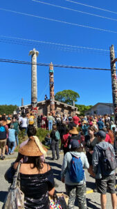
I currently live in a town called Masset, at the very north end of the island of Haida Gwaii. I live in a part of town called “uptown,” but greater Masset is broken into a few neighbourhoods. Uptown is considered the newer part of town or the downtown. The term “downtown” is used fairly loosely here, considering it spans two main streets and one intersection. Old Masset, or the Village of Old Masset, is the Indigenous reserve area where the pre-settlement Masset village existed. Newtown is an Old Masset community just off Highway 16, right out of uptown. It is a newer Indigenous reserve village that was created to sustain the population and help the current housing crisis. The population in Masset is currently 793, not including the 475 residents who live in Old Masset (Statistics Canada, 2021).
The Island of Haida Gwaii is located approximately 48-140 km from the mainland islands and is separated by one of the most dangerous straits of waters, the Hecate Strait. Haida Gwaii is a group of islands located on the northern coast of British Columbia. The name Haida Gwaii translated from Haida, means “Islands of the People.” It is the ancestral land of the Haida people. Haida traditional territory covers parts of southern Alaska, the archipelago of Haida Gwaii, and its surrounding waters (History of the Haida Nation, n.d.). Haida Gwaii is considered one of the most isolated islands in Canada. Originally, this island was called the Queen Charlotte Islands, named by Captain George Dixon in 1787, but its original ancestral name was restored in 2010 (Foster, 2012).
Archeological evidence suggests Haida people have occupied this island for at least 6000 to 8000 years. The pre-contact population on Haida Gwaii was in the tens of thousands. There were several towns dispersed throughout the islands. Contact with Europeans on this island introduced several diseases, including measles, typhoid, and smallpox, and the population fell to just under 600 by 1915. With this drastic reduction in population, many of the smaller and more isolated towns and settlements were forced to relocate to the two larger settlements of Skidegate and Masset (History of the Haida Nation, n.d.). Juan Perez was the first recorded European to have found these islands in 1774, and James Cook followed in 1778. Fur traders began coming to trade with the Haida for Sea Otter pelts and other furs but never established official trading posts on the island. Missions were established later in the century. Non-Haida settlers began arriving in the early 1900s (Foster, 2012). Multiple logging camps were established after 1910. The Canadian Forces set up a small naval communications base in Masset in the 1970s, which brought many more off-island settlers and infrastructure developments. The elephant cage still stands to this day just outside of town. Uptown Masset’s infrastructure developed significantly with the arrival of this military base. This was the beginning of the permanent settlement of non-Indigenous people on Haida Gwaii. Towns like Daajing Giids (formerly known as the town of Charlotte) and Port Clemence were established as a consequence of the military presence here.
The islands of Haida Gwaii were formed by tectonic plates that shifted from the South Pacific to their present location. Haida Gwaii was also missed by the last Ice Age and therefore escaped glaciation, which makes this island area biologically unique. Numerous plants are found here that have only been found in Haida Gwaii and Japan (Foster, 2012).
Pre-European vegetation (prior to 1850) was very similar to that of temperate rainforest areas in Southeast Alaska and the northern coast of British Columbia. Paleobotanical studies indicated that forests on Haida Gwaii had existed almond unchanged from their present form for the last 5500 years. Significant natural change only occurred when the importance of the red cedar increased during the past three millennia (Pojar, 2014).
The establishment of logging camps and the arrival of settlers impacted, directly and indirectly, native vegetation. Trees were cleared for construction and firewood, trails were hacked, roads were formed, domestic animals were brought to the island, and non-native species, both plants and animals, were introduced. Some of the domestic animals eventually went feral, such as the wild Cows in the Naikoon Conservation land right by Masset (Pojar, 2014). Native species of plants and animals are at risk with the introduction of non-native species of plants and animals. Several species of seabirds are at risk due to the introduction of predators such as rats, squirrels, and raccoons (Foster, 2012). Species found in Gwaii Haanas and the Haida Gwaii archipelago are endemic or unique and not found anywhere else in the world. There are eleven species of mammals that are native to this area, like the black bear, the river otter, the Haida ermine, the silver-haired bat, and the deer mouse (Parks Canada, 2019)
Locals in Masset and on the Island have noticed, especially recently, the diminishing population of certain wild ocean fish and crabs. This can be attributed to the rising fishing tourism industry that exists here in the summer months. My partner grew up here in Masset. She and her family have told me many stories about how the beaches used to be filled with crabs on the shore. To catch crab, you would simply have to put your net in the water while wadding and catch at least one or more. Today, crabs are a lot harder to catch and see. Haidas have always depended on fishing and hunting as their primary source of food, and is a large part of their culture. Seeing this diminishing fish population caused by disruptive tourism and fishing industries is concerning for the Haidas and is a growing discussion among the Haida Nation Council.
Sources:
Banner, A., W.H. MacKenzie, J. Pojar, A. MacKinnon, S.C. Saunders, and H. Klassen. 204. A field guide to ecosystem classification and identification for Haida Gwaii. Prov. B.C., Victoria, B.C. Land Manag. Handb. 68. www.for.gov.bc.ca/hfd/pubs/Docs/Lmh/Lmh68.htm
Foster, B. (2015). Haida Gwaii. In The Canadian Encyclopedia. Retrieved from https://www.thecanadianencyclopedia.ca/en/article/haida-gwaii
Government of Canada. (2019, May 8). Gwaii Haanas National Park Reserve, National Marine Conservation Area Reserve, and Haida Heritage Site. Parks Canada Agency. Retrieved October 17, 2022, from https://www.pc.gc.ca/en/pn-np/bc/gwaiihaanas/nature/faune-wildlife
History of the haida nation. Council of the Haida Nation. (n.d.). Retrieved September 27, 2022, from https://www.haidanation.ca/haida-nation/
Pojar, J. (2014). An introduction to the plant ecology of Haida Gwaii, Prov. B.C., Victoria, B.C. Land Manag. Handb. 68. From https://rgis.cefe.cnrs.fr/Publications/Symposium_Introduction_Pojar.pdf
Statistics Canada. 2022. (table). Census Profile. 2021 Census of Population. Statistics Canada Catalogue no. 98-316-X2021001. Ottawa. Released September 21, 2022.