Niagara Falls
February 19, 2024 By: Miranda Chapman
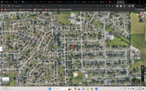
Location: Churchill St, Niagara Falls, ON

Noraman Fennema
HIST3991: Environmental History
Miranda Chapman
19 February 2024
Over 450 million years ago, the Niagara Region of southern Ontario was part of a warm, shallow ocean that eventually dried up and created the Niagara Escarpment through erosion (Giants Rib Escarpment Education Network, n.d.). There are many waterfalls that tumble over the Escarpment, the most notable of which is the Niagara Falls (Gayler, 1994). A diverse landscape of lakes, waterways, plains, and escarpments, the region was formed before the extinction of the dinosaurs, with the recession of the last great glaciation carving out the Great Lakes around 10,000 years ago (Berton, 1992). Due to its proximity to the Great Lakes, the Niagara Region does not experience harsh winters the way other areas of Ontario do, the summers are warm, and spring is known to bring high winds (Gayler, 1994). Land within the Region was named “The Fruit Belt” because the soils and climate are conducive to agriculture and growing tender fruit and grapes. Historically, grain was the major crop in the area with grapes becoming more prevalent in the 1870’s, and peaches in the early 1900’s. The region is also the location of the most northern part of the Carolinian Life Zone, and as such the location of many unique and endangered species in Canada (Niagara Parks, n.d.).
There is disappointingly little information to be found on the Indigenous history of Niagara, and even less through an Indigenous lens. From what I have found, the land that the city of Niagara Falls is on was the traditional territory of the Attiwondernok, later named “Neutral” by a French explorer, with archeological evidence suggesting they had been there since the 1500’s (Canadian Encyclopedia, 2012; Gayler, 1994; Native Land, n.d.). The Attiwondernok were a sedentary tribe, dependent upon agriculture, hunting, and fishing, as well as partaking in the growing fur trade, until they were attacked by the neighbouring Seneca in the 1600’s and almost entirely eradicated. The Seneca maintained the lifestyle of the Attiwondernok in the region until the late 1600’s when the Ojibway (later named the Mississaugas) forced out the Seneca and took over the lands (Gayler, 1994). European colonization of the land began in the early 17th century, with the French conducting missionary work and expanding the fur trade. The French built Fort Conti in 1679 to protect the established trade routes from American colonization, and the first permanent settlement in the area was built shortly after. The British captured Fort Conti in 1759, renaming it Fort Niagara, and expanded permanent settlements in the area (Canadian Encyclopedia, 1992). In 1764 and 1781, treaties were signed with the Seneca and Mississaugas, respectively, further expanding agricultural land use in the region.
The city of Niagara Falls was established in 1904, after over 100 years of smaller communities, villages, and towns joining together. The city further expanded in 1963 and 1970 with the incorporation of nearby townships of Stamford and Chippawa, respectively (Canadian Encyclopedia, 2012). Utilization of the Canadian side of Niagara Falls for power began in 1758, when a sawmill was erected just above the Falls (Berton, 1992), but it wasn’t until 1905-1906 that the Falls were utilized for major power generation for the city, with large amounts of water being diverted through canals under the city and the flow of the Welland River being reversed in order to supply enough water to the reservoirs. In 2013, this system was expanded by the addition of another tunnel under the city to divert water and increase electricity output. Concern for the esthetics of the area around the Falls was presented to the Federal government in the 1850’s, and in 1885 the Niagara Falls Park Act was passed into law with the goal of protecting the nature space near to the Falls (Niagara Falls Info, n.d.). Though the Falls’ notoriety was well established in the 19th century, it was not until the 1920’s that tourism became a major part of the Niagara Falls economy (Canadian Encyclopedia, 2012).
References
Berton, Pierre (1992). Niagara: A history of the Falls. Anchor Canada.
Canadian Encyclopedia (2012). Niagara Falls. https://www.thecanadianencyclopedia.ca/en/article/niagara-falls-ont
Gayler, H.J. (1994). Niagara’s changing landscapes. Carleton University Press. [electronic source]. https://canadacommons-ca.ezproxy.tru.ca/artifacts/1866737/niagaras-changing-landscapes/2615684/view/
Giants Rib Escarpment Education Network (n.d.) Escarpment origins – Ancient seas and fossils. https://www.giantsrib.ca/escarpment-origins-ancient-seas-and-fossils/
Niagara Falls Info (n.d.). Niagara Parks Commission history – The beginning of the Parks. https://www.niagarafallsinfo.com/niagara-falls-history/niagara-falls-tourism-history/the-history-of-niagara-parks-commission/the-beginning-of-the-niagara-parks/#:~:text=In%20order%20to%20preserve%20the,American%20borders%20at%20Niagara%20Falls.
Native Land (n.d.). Native Land Digital. https://native-land.ca/
Niagara Parks (n.d.). Nature in the Niagara Region. https://niagaraparks.com/explore/explore-the-niagara/nature-activities-in-niagara/#:~:text=The%20Niagara%20Peninsula%20lies%20between,region%20in%20eastern%20North%20America.